

Latest News
How tornadoes are formed and why they are so much bigger in the US

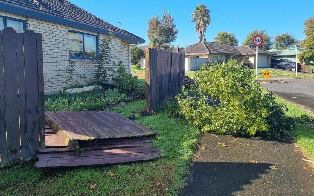
The tornado or damaging wind that smashed through part of east Auckland about 9.30pm on Sunday was associated with a line of thunderstorm clouds moving quickly from the west to the east.
Such damaging winds could happen when thunderstorms were “particularly vigorous”, MetService meteorologist Dan Corrigan said.
On Sunday night, the thunderstorm cells were lined up in such a way that they fed into each other and kept each other going.
The weather feature that caused the damage may well have been a small tornado, but MetService was uncertain because it had not seen any photos or video that showed a funnel cloud reaching to the ground.
“You can have strong down drafts out of thunderstorms that produce damaging wind gusts.”
The risk of damaging winds was the same, regardless of whether they came from a small tornado or from gusts.
Between 8.30pm and 9.30pm Sunday, the strongest gusts recorded in the Auckland area were in exposed locations – 96km/h at the Tiritiri Matangi lighthouse and 87km/h at Whangaparāoa.
Wind speeds at East Tāmaki would have been much higher than that, Corrigan said, but he could not give a range.
There is uncertainty about the number of tornadoes in New Zealand each year and it is thought some in remote areas are probably undetected.

Trees damaged in East Tāmaki. Photo: RNZ / Matthew Theunissen
But so far in 2023, two events thought to have been tornadoes have been reported in this country – in Greymouth in March, and at Waihi Beach in February.
NIWA meteorologist Dr Richard Turner has said the typical number of tornadoes observed in New Zealand was roughly about seven to 10 a year.
Some years had more, maybe as many as 20 or 30, but some of those would not have been observed.
Based on observations and past studies, researchers thought areas of New Zealand most likely to have tornadoes were Taranaki, the West Coast, Horowhenua, and the Waikato coast.
It is hoped researchers will get a better idea of the number of tornadoes in this country from a project under way at NIWA, where three decades of weather data is being run through powerful computers.
Huge amounts of information is being produced, which will need significant analysis, but it is thought one output could be a better understanding of the tornado risk in different parts of the country, along with the changes in risk over time.
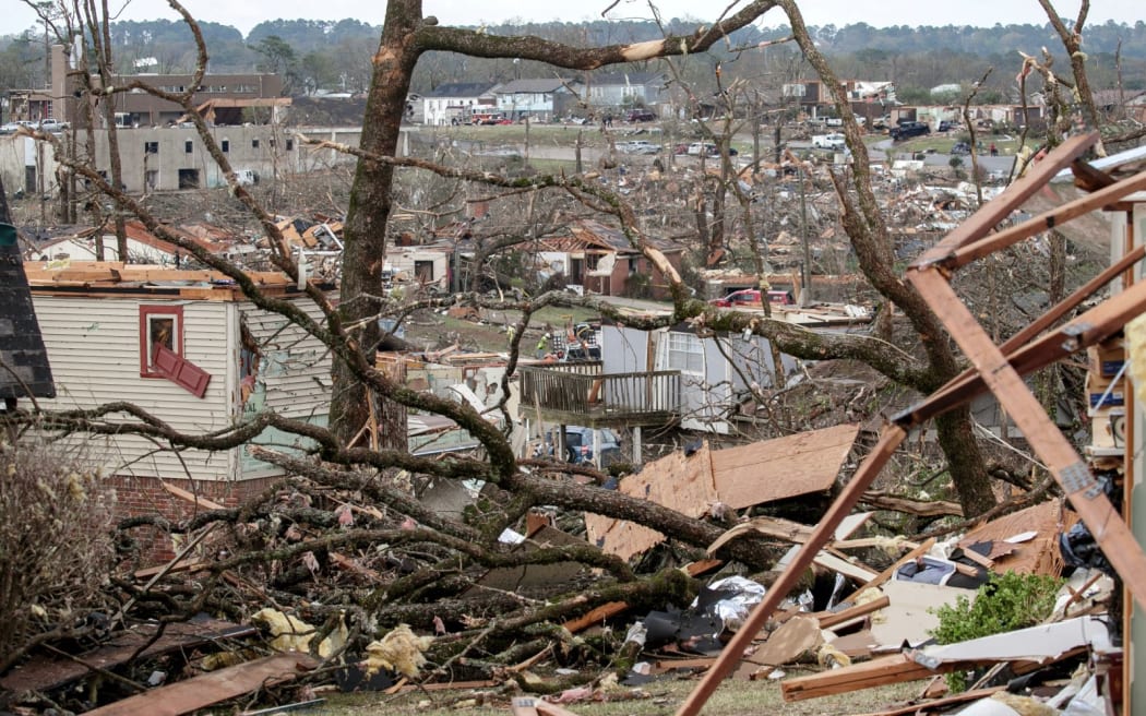
The damaged remains of the Walnut Ridge neighborhood is seen on 31 March 2023 in Little Rock, Arkansas in the US. New Zealand tornadoes are not nearly as large as those that cause massive destruction in parts of the US. Photo: BENJAMIN KRAIN
Researchers could also look for factors that influence changes from year-to-year, such as the impact of La Niña or El Niño.
NIWA described tornadoes as large rotating columns of air – a vortex – that happened in association with a thunderstorm.
Tornadoes had winds that travelled at very high speeds around a central area of very low atmospheric pressure.
The parent thunderstorms typically had very strong updrafts with speeds of 36km/h, and which were developed in an environment that caused the updraft to rotate, potentially causing a tornado, NIWA said.
Updraft speeds of more than 150km/h or more had been reported in the United States but not in this country.
In New Zealand, most tornadoes were associated with bands of thunderstorms embedded in a strong, unstable northwesterly flows ahead of a front.
“The thunderstorms have very strong updrafts and if these occur in an environment in which the wind directions rotate counterclockwise as the air rises, the updraft can start to spin,” NIWA said.
In those cases something called a mesocyclone – a rotating vortex that can be as small as 1-2km in diameter – could form, and it is from mesocyclones that tornadoes were spawned.



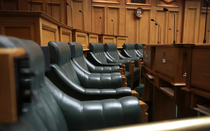
The chief executive of the Parliamentary Service is confident there will be enough room to accommodate the increased number of MPs and their staff coming into Parliament.
On current numbers, up to 131 MPs could be sitting in the Chamber following the election, brought on by a record overhang result.
Clerk of the House of Representatives Dr David Wilson told the Spinoff that currently the debating chamber had enough chairs to seat 124 MPs – including the Speaker of the House – and work was being done to accommodate more by altering the seating arrangement.
In a statement, Parliamentary Service chief executive Rafael Gonzalez-Montero said planning for a larger Parliament had been going for “some time”.
“Now that the election results have confirmed an increase to the number of members we are looking at several options.
“We are confident we will be able to accommodate all members within the Chamber.”
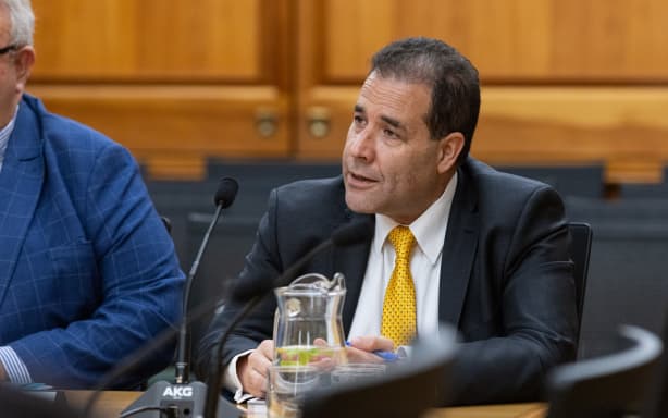
VNP / Phil Smith
Gonzalez-Montero said office accommodation for members and their staff would be “stretched” for a short time, but the new Members’ Building was only a few months away from “practical completion”.
That building – located behind Parliament – was due to be ready to occupy in April next year and had capacity to accommodate around 30 backbench MPs.
“All members should be in fit-for-purpose accommodation from that point,” Gonzalez-Montero said.
Following the 2023 election, 123 MPs sat in the Chamber – a record number at the time. That decreased to 122 following the resignation of National MP Judith Collins.
Collins held the seat of Papakura and stepped down in May and Parliament voted against holding a by-election because it was too close to the election.
The election result also meant high-ranking National Party MPs like Chris Bishop, Paul Goldsmith, Nicola Willis and Gerry Brownlee – Speaker of the House and an MP for 30 years – would likely not make it back into Parliament.
Only resigning or retiring MPs were permitted to give a valedictory speech meaning none of them would get the chance to give a valedictory statement.
Asked if their would be special allowances for valedictories, Wilson said in a statement that normally only MPs were allowed to speak in the House but the House could suspend its own rules or temporarily alter them.
“It could do so to allow former members to address the House.”
Wilson said no such arrangements could be made until the next Parliament opened and members sworn in.
rnz


Police say person who fired gun at officers still at large

New Zealand sides named for RLWC finals

Parliamentary Service working on extra chairs and offices for increased number of MPs


-

 Latest News2 months ago
‘Chilling’: Business groups speak out against National’s supermarket break-up plan
-
 NZ News2 months ago
Tom Phillips report: The missed opportunities to find the children
-

 Politics2 months ago
National vows to try to split Pak’nSave and New World
-

 Latest News2 months ago
Cars bearing Chinese police markings stir unease in Auckland
-

 Fiji News2 months ago
Plans to have new Constitution by Dec 24th 2026
-

 NZ News2 months ago
Cop who stole $68,000 can now be named as champion Muay Thai fighter Haimona Tamati-Te Paki
-

 Politics2 months ago
MBIE confirms botched biometric projects costs blown out to $50.7 million
-
 Latest News2 months ago
Five Karangahape Road venues lose their liquor licences after police intervention